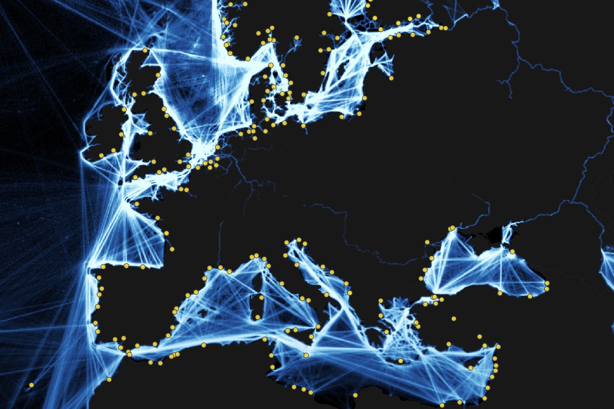
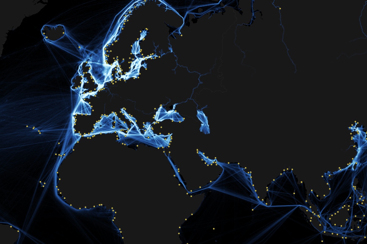
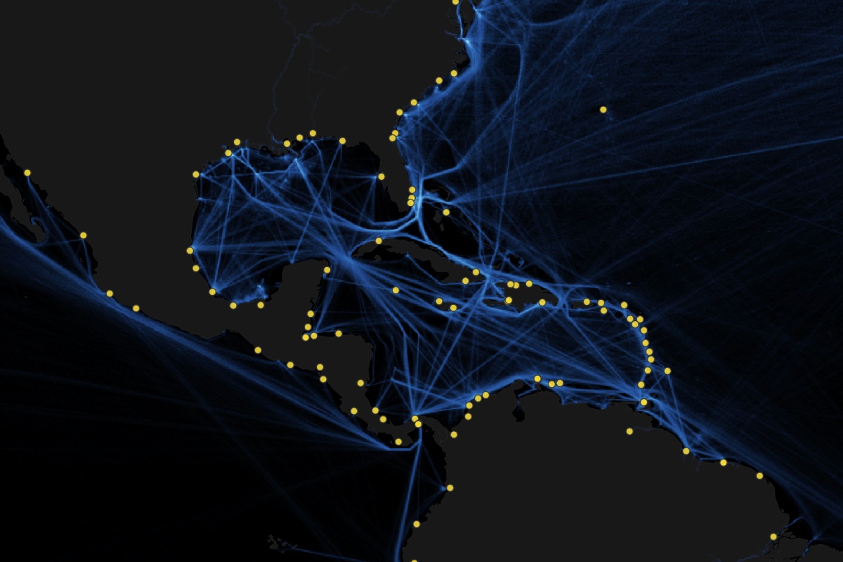
This map effectively highlights the concentrations of commercial shipping activity worldwide, giving viewers a detailed understanding of global shipping patterns. The raster data used for this map was a collaborative effort between the World Bank and the IMF, ensuring accuracy and comprehensiveness. In Â鶹´ĺ, the data is easily explored, loading quickly as you pan and zoom into areas of interest.