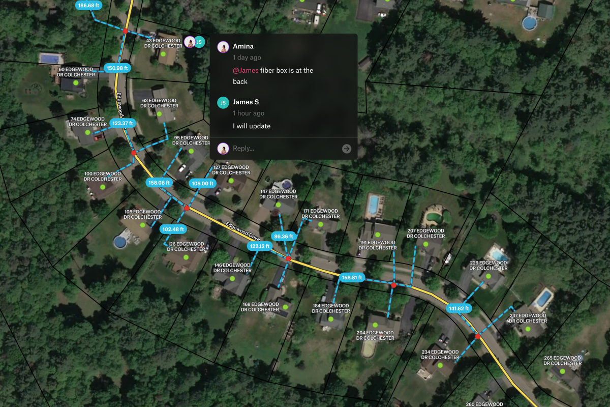
With Â鶹´ĺ, your team can use telecom GIS and geospatial mapping to optimize network infrastructure, accelerate FTTx deployment, and turn complex telecom data into collaborative, decision-ready maps and dashboards.

Make your source-of-truth accessible to those who rely on it daily.


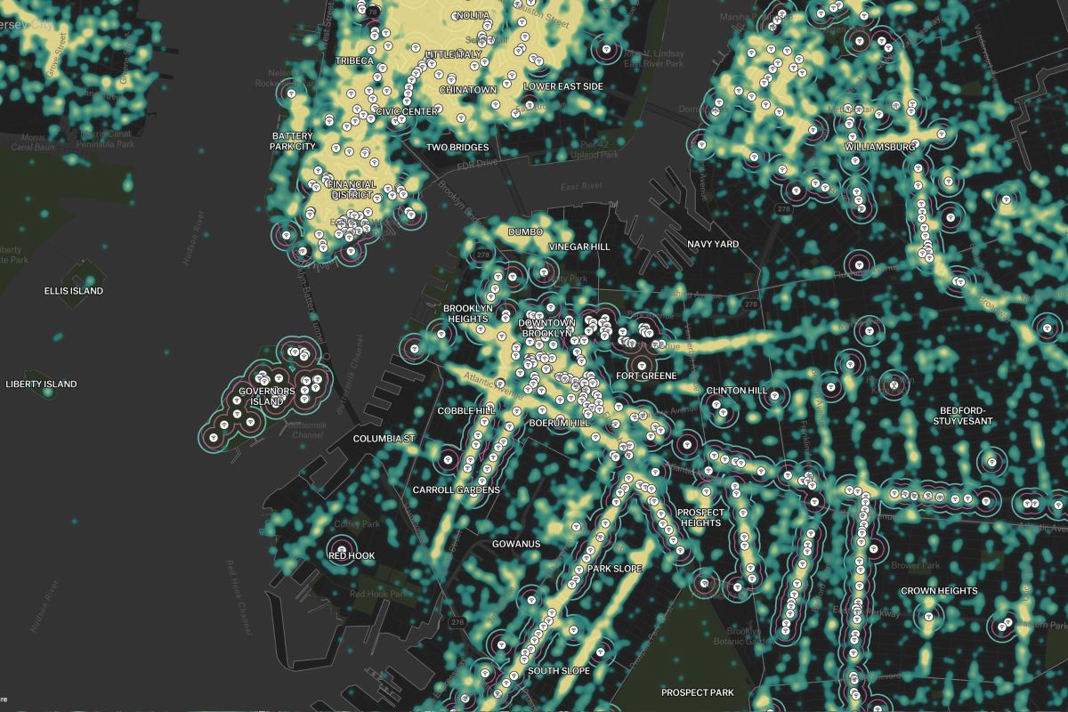
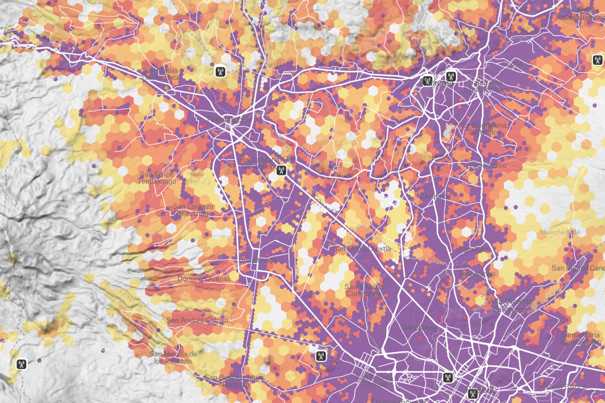
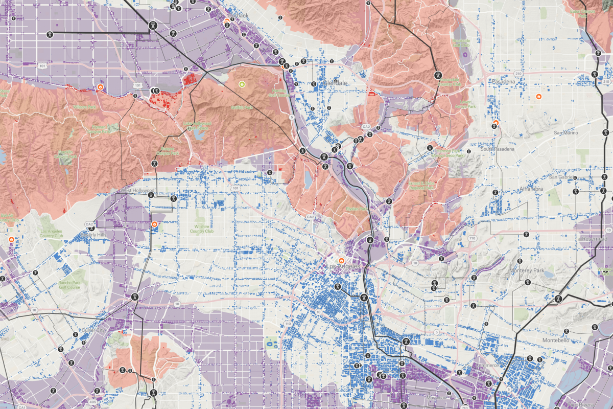
GIS (Geographic Information Systems) is used in the telecommunications industry to design, deploy, and maintain network infrastructure, optimize coverage, plan FTTx and 5G rollouts, manage assets, and turn geospatial data into actionable maps for smarter operational and market decisions.
Geospatial data is essential for telecom networks because it enables GIS-driven planning and optimization of network infrastructure, improves coverage and FTTx deployment accuracy, supports real-time monitoring and emergency response, and helps the telecommunications industry reduce costs while delivering better service.
The difference between telecom GIS and traditional GIS is that telecom GIS is purpose-built for the telecommunications industry to model, design, and optimize complex network infrastructure such as FTTx and 5G using high-resolution geospatial data and connectivity analysis, while traditional GIS provides more general, 2D geographic mapping tools.