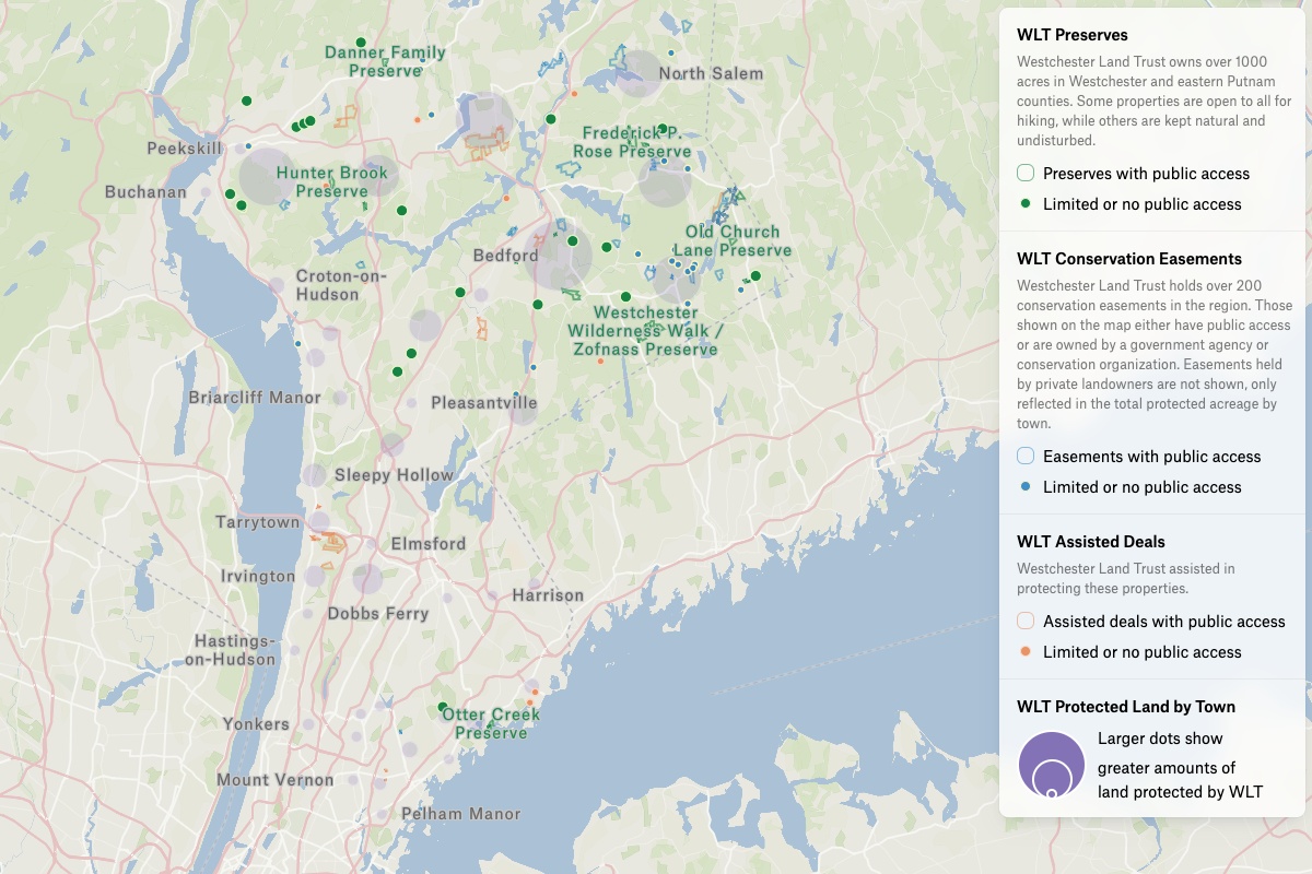
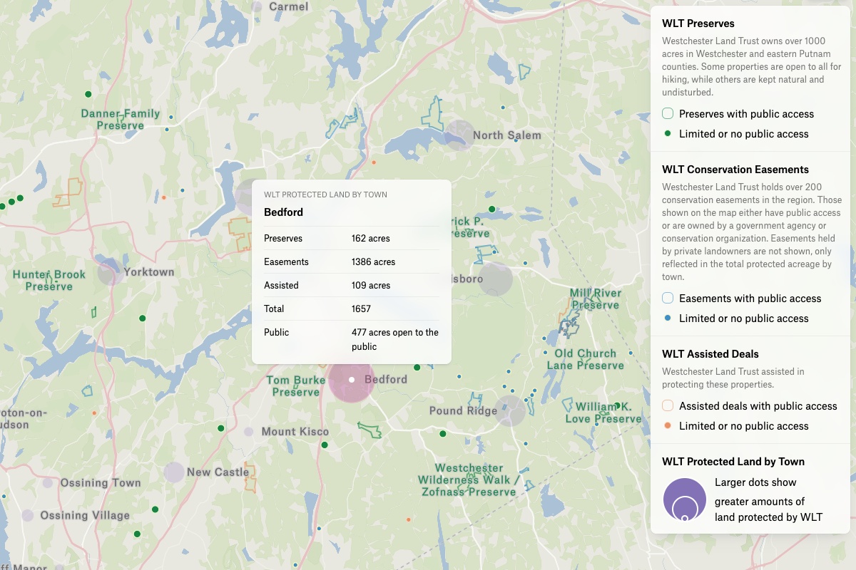
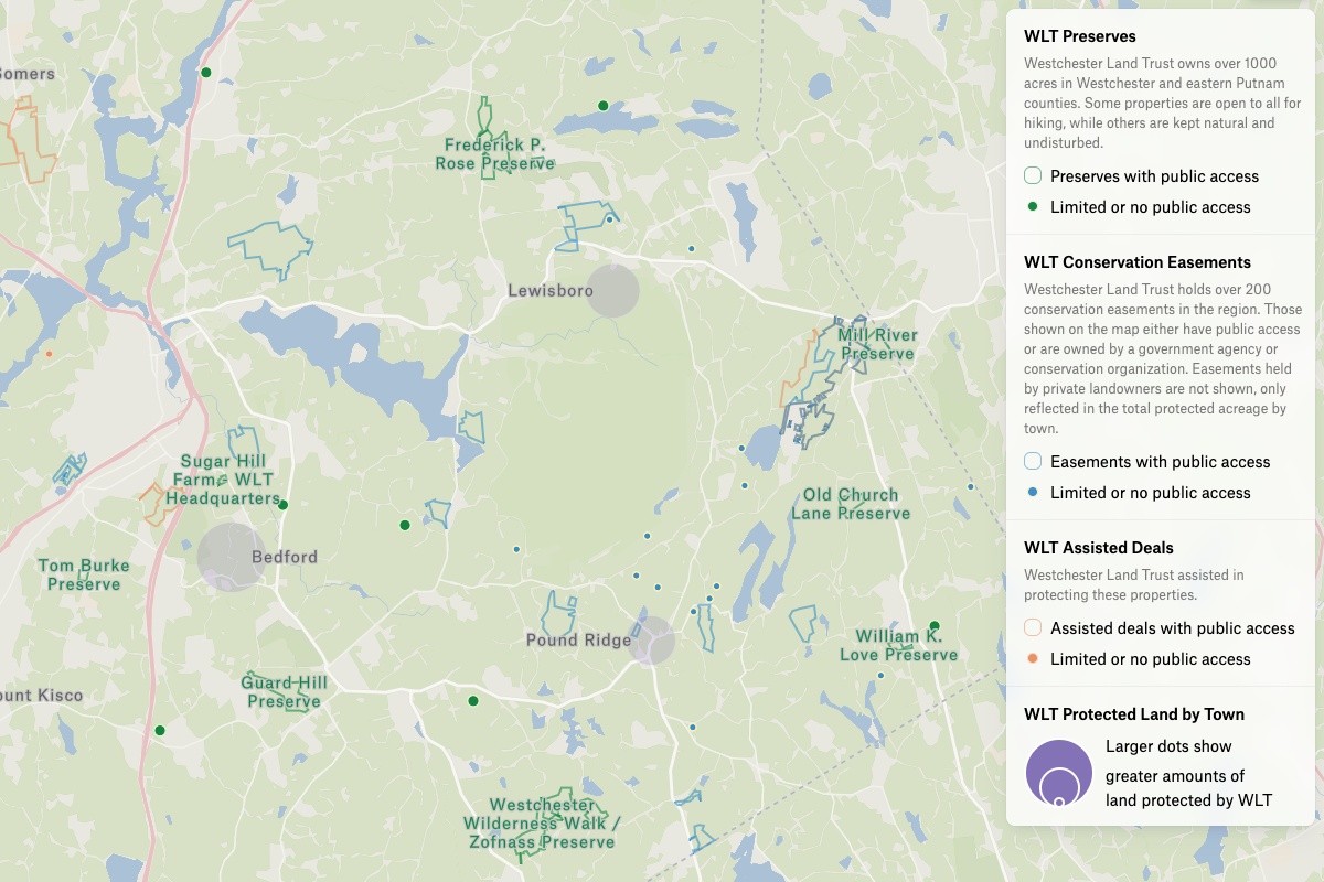
WLT was looking for a way to show how much the land trust has accomplished — the organization has protected over 9,000 acres in Westchester and Eastern Putnam Counties. So Gentian had to experiment with different symbology and come up with a way to show the influence of WLT on the region without disclosing the location of some of the private land plots. “We focused on understanding what types of land we are showing and how we are showing it,” she adds.The biggest challenge for Gentian was showing the land trust’s impact in the region without disclosing the locations of some privately owned land. So she calculated how much land WLT protected in each town in NY, then uploaded data into Â鶹´ĺ, and styled it by the total acreage.The creation of the interactive map using Â鶹´ĺ was a big accomplishment for the team that had limited resources and a tight timeline — the map was completed in less than three weeks. WLT is continuing to refine their approach to effectively communicate information about their protected land. For more on how the WLT was successful at using Â鶹´ĺ to tell their story, read on here.